
Episode Overview
This is the second episode of the Prospecting PA Audio Archive, and it answers the question every prospector in the northern tier of Pennsylvania or southern New York has asked at some point: where did all this gold in my pan come from?
The short answer: Canada. The long answer involves two miles of ice, six local ice margin positions, and a hundred and seventy million ounces of gold that originated in the Abitibi Greenstone Belt of Ontario and Quebec.
You'll learn:
- The Last Glacial Maximum — 26,000 years ago, the Laurentide Ice Sheet covered everything from the Arctic to Long Island, and your favorite creek was buried under 3,000 feet of ice
- The Abitibi connection — the Archean-age gold belt in Canada that was the ultimate source, and how the ice picked up the gold and carried it south
- The six local ice margins — Wells Bridge, Oneonta, New Berlin, Cassville-Cooperstown, Middleburg, and Valley Heads, and what each one means for where the gold concentrated
- Why the gold in your pan is fine — the glacial transport mechanism and why flour gold is what you should expect
- The open research question — the Fleisher (1993) hypothesis that the gold may be more local than the standard Abitibi story suggests, and how a prospector with a microscope could help answer it
- Practical field takeaways — where to pan, when to go, what to look for
Image Gallery
Howdy partner, and welcome back to the Prospecting PA audio archive. Last time, we covered how Pennsylvania got its lode gold — the Cornwall-type story, the Triassic diabase, the sixty-seven thousand ounces from a mine that was really an iron mine. If you missed it, go back and listen. That episode sets the foundation for what we're covering today.
Because today, we're flipping the story. We're going up to the northern tier, to the Susquehanna River and all its tributaries, and we're asking a different question. The question prospectors have been asking for two hundred years: where did all this gold in my pan come from? And the answer is going to surprise you.
Because the gold in your pan at Meshoppen Creek, or in the Susquehanna at Tunkhannock, or in the Unadilla River in Chenango County, New York — that gold did not come from Pennsylvania. It did not come from New York. It came from Canada. From a place called the Abitibi Greenstone Belt, in Ontario and Quebec, more than three hundred miles to the north. It got here in pieces. It got here locked inside boulders of rock that the Laurentide Ice Sheet picked up, carried south for thousands of years, and then dropped when the ice melted. The gold you find in the Susquehanna basin is, geologically speaking, a Canadian immigrant. And the story of how it got here is one of the most dramatic geological events in Earth's recent history.
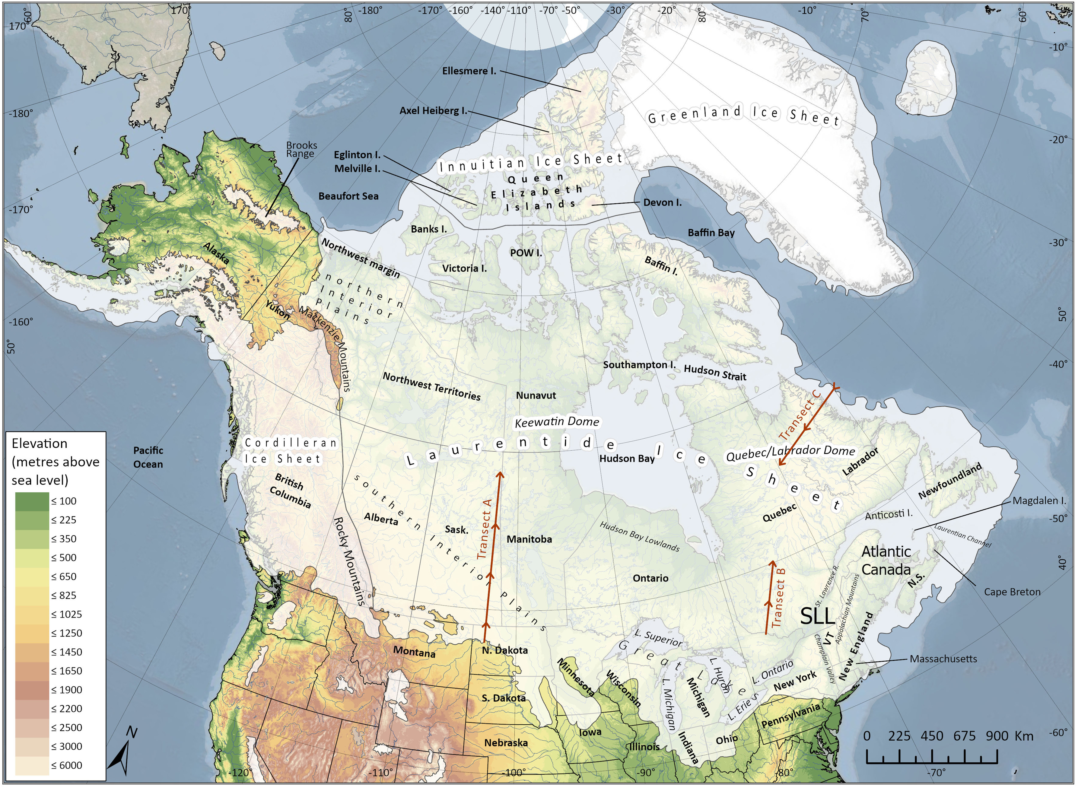
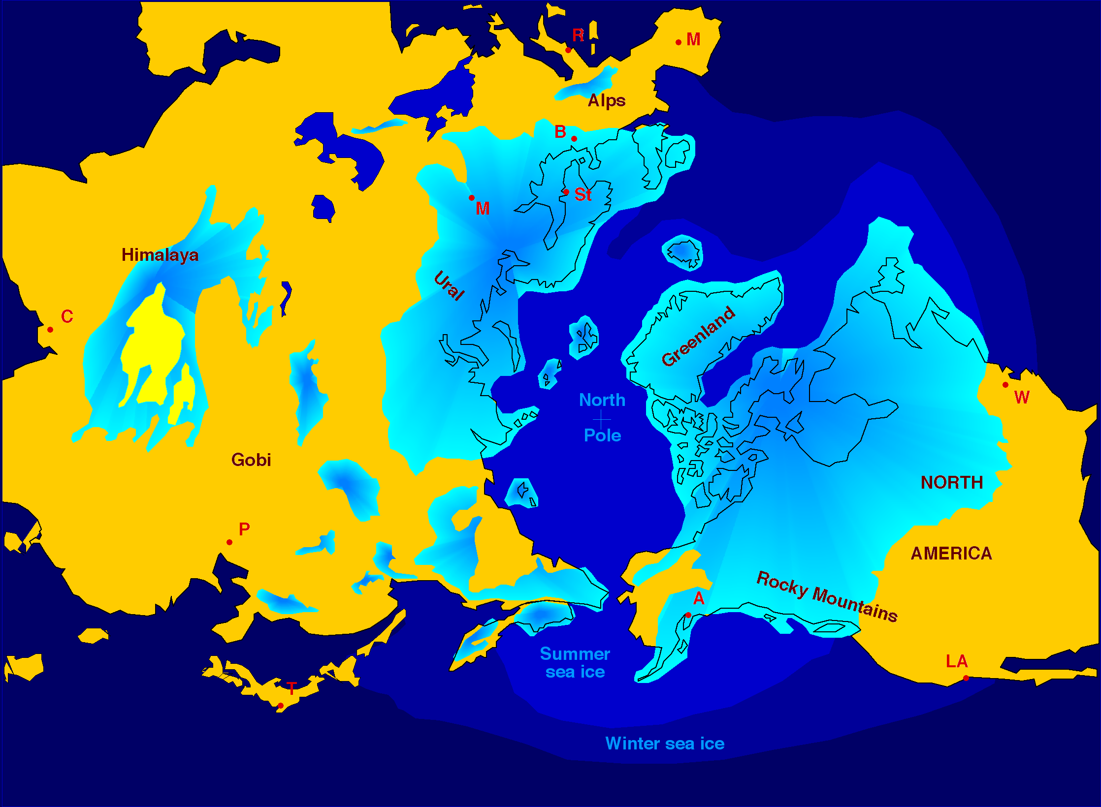
Picture this. Twenty-six thousand years ago. The last glacial maximum. A continental ice sheet — what geologists call the Laurentide Ice Sheet — covered everything from the Arctic Ocean down to present-day Long Island, New York, northern New Jersey, and southern Pennsylvania. We're not talking alpine glaciers. We're not talking ice caps. We're talking two miles of ice in some places. In Otsego County, New York — right where the user I'm building this for prospects — the ice was about three thousand feet thick, give or take sixteen hundred feet.
That's a thousand feet of ice above the highest point in the area. The whole landscape, the whole Catskills, the whole Endless Mountains, the whole Susquehanna valley — all of it, buried. Pressed down. Crushed.
For two hundred miles north of the ice front, the ground was frozen permafrost. For another thousand miles north, it was active ice. The center of the ice sheet, the dome, sat over what's now Hudson Bay. From that dome, ice flowed outward in every direction — north toward the Arctic, east into the Atlantic, west into the prairies, and south, into what is now the United States.
Now, here's the part most people get wrong. The Laurentide Ice Sheet didn't just bulldoze its way south like a slow-motion wall. It behaved more like a system of valley glaciers that were all connected. As the climate warmed, around twenty thousand years ago, the ice started to retreat. And as it retreated, it didn't retreat evenly. It retreated in lobes, in tongues, in fingers of ice that followed the pre-existing river valleys. The Susquehanna valley became one of those ice tongues. The Delaware valley became another. The Hudson, the Lackawanna, the Chenango — all of them, ice-filled channels that carried the continental ice south, then east, then south again, in long sinuous fingers that followed the lowest ground.
So the ice is moving south. It's three thousand feet thick in places. It's carrying everything that's been picked up along the way. And here's the key question: where did the gold come from?
The answer is the Abitibi Greenstone Belt. That's a geological region in Ontario and Quebec — actually two regions, the Abitibi in Quebec and the Wawa-Abitibi in Ontario — that has produced more than a hundred and seventy million ounces of gold since nineteen oh one. It's one of the largest gold-producing regions on Earth. The rocks there are Archean age — two point seven billion years old, some of the oldest rocks in North America. They're loaded with gold-bearing quartz veins. The veins formed when superheated water circulated through cracks in the ancient volcanic rock and deposited gold as it cooled.
When the Laurentide Ice Sheet formed, it started scraping across those gold-bearing rocks. The ice picked up fragments — boulders, cobbles, sand, silt — including trace amounts of gold that had weathered out of the quartz veins and been incorporated into the local soil and stream gravels over millions of years. The ice carried all of that south, mixing it with debris from every other rock formation it crossed. By the time the ice reached Pennsylvania and New York, it was carrying a dilute but real gold content — flour gold, mostly, sub-millimeter flakes that had been liberated from their host rocks and were now embedded in the glacial till.
So the ice retreats. It doesn't go back all at once. It pauses, and during those pauses, it dumps material. The geologists call these pauses "ice margin positions" or "stillstands." In the Oneonta area, in the upper Susquehanna basin, the USGS and the New York State Geological Survey have identified six distinct ice margin positions. Let me walk you through them.
The southernmost position is called the Wells Bridge moraine. It sits between Oneonta and Sidney, New York, running roughly east-west. This is the ice position that matters most for the modern prospector, because the outwash plain downstream of this moraine — the sand and gravel that the meltwater rivers carried away from the ice front — is where the modern streams have re-concentrated the gold.
North of Wells Bridge, the next position is the Oneonta margin. Then New Berlin. Then the Cassville-Cooperstown position, which is significant because it represents a readvance — the ice actually moved forward again for a while before resuming its retreat. Then Middleburg. And finally, the northernmost, the Valley Heads moraine, way up in central New York near Syracuse.
Each of these positions left behind a moraine — a ridge of till, sand, and gravel pushed up at the ice front. And each moraine is potentially gold-bearing, because the till in the moraine came from the same Canadian source. The gold content in any individual moraine is tiny — we're talking parts per billion — but it's real.
Now, here's what matters for the modern prospector. The till itself is unsorted. The gold is scattered through it at low concentration. You can't just dig a hole in a moraine and expect to fill your pan with nuggets. What you need is natural concentration. And that's what streams provide.
When a stream cuts through glacial till, the water does the work of sorting. The lighter material — sand, silt, clay — gets carried downstream. The heavier material — gold, black sand, magnetite — settles out. Behind boulders. In the inside bends of the stream. In the cracks and crevices of the bedrock. In the natural riffles that form where the water slows down.
This is why the classic panning advice is so consistent across every gold-bearing region: pan the inside bends. Pan behind the big rocks. Pan the black sand. The black sand is mostly magnetite, and it concentrates with the gold because they're both heavy. If you're finding black sand, you're in the right kind of ground to find gold.
In the Susquehanna basin, the modern streams — the Susquehanna itself, Meshoppen Creek, Tunkhannock Creek, Bowman Creek, the Unadilla, the Chenango — all of these are cutting through glacial deposits. The gold content is real but small. We're not talking nuggets here. We're talking flour gold, with the occasional small flake. Some prospectors report occasional pickers, and there are stories of a small nugget found behind the Wyalusing Hotel decades ago, but the dominant size class is fine.
Now, here's the thing that I find most interesting, and the thing that the official geological reports don't fully answer. The official story is that the gold in the upper Susquehanna basin came from the Abitibi Greenstone Belt, transported by the Laurentide Ice Sheet. And that's probably right. But there's a competing hypothesis, and it's worth knowing about.
Some geologists have argued that the immediate source of the gold in the upper Susquehanna might be local Paleozoic bedrock, not far-traveled Canadian Shield debris. The reasoning goes like this: the Laurentide Ice Sheet reached its maximum extent and then started to retreat. As it retreated, the long valley ice tongues that filled the Susquehanna basin were no longer connected to the main ice sheet. They became "dead ice," sitting in the valleys, slowly melting. And the dominant process during the deglaciation wasn't far-traveled ice flow — it was local reworking. The dead ice melted, and the water that flowed off of it reworked the local glacial deposits, concentrating the gold in the modern stream beds.
If that's the case, then the gold in your pan might have a more local source than the Abitibi. It might be Paleozoic sediment reworked by valley ice, not Canadian Shield rock transported wholesale. The problem is, nobody has done a definitive gold grain morphology study in the upper Susquehanna basin. No one has looked at the gold under a microscope and asked: is this gold grain's shape consistent with long-distance glacial transport, or with short-distance reworking?
The Pennsylvania Geological Survey doesn't have a till geochemistry program. The New York State Geological Survey has done some work, but not in the upper Susquehanna. There's a real research opportunity here. A prospector with a microscope, a sample of black sand concentrate from a few local streams, and the patience to look at fifty gold grains could potentially answer this question.
So what does this mean for you, partner, when you're standing in the creek with your pan?
Number one: pan where streams cut through glacial deposits. The Susquehanna main stem does this everywhere. The tributary creeks do it in their lower reaches, where they enter the main valley. The hilltop streams don't do it — they're eroding into bedrock, not into glacial till.
Number two: look for the inside bends, the behind-the-boulder spots, the bedrock cracks. That's where the modern water has done its work of concentrating the gold out of the till.
Number three: don't expect nuggets. Expect flour, fine flakes, occasional small pickers. If you find a coarse picker or a nugget, you found something unusual. Celebrate it. But don't go into a Susquehanna basin stream expecting California-style nugget hunting.
Number four: consider the seasonal cycle. Spring snowmelt is your friend. Every spring, the high water reworks the gravel bars, re-exposes gold, and re-concentrates the pay streaks. If you can hit a stream in late April or early May, after the water has come up and started to drop, you're hitting it at the optimal time.
Number five: think about moraine positions. The Wells Bridge moraine in the Oneonta area is the southernmost ice position in the upper Susquehanna basin. Outwash downstream of any moraine is more likely to carry concentrated gold than till on top of the moraine itself.
So that's the glacial gold story, partner. Twenty-six thousand years ago, a two-mile-thick ice sheet covered everything from the Arctic to Long Island. It scraped gold-bearing rocks out of the Canadian Shield, mixed them with everything else it was carrying, and deposited a thin layer of gold-bearing till across the northern United States. When the ice melted, the streams went to work, concentrating the gold in the modern gravels. And today, two hundred years after the first prospectors started panning these creeks, you can still find color.
The honest assessment: the gold is real but small. The northern tier of Pennsylvania and the southern tier of New York are not California. They're not even Vermont. But they're close to home, they're free to access, and on a good day with the right technique, you'll bring home enough color to make it worth the drive.
Next time, we're heading to New Jersey. The Watchung Mountains copper mines, the Schuyler Mine, the Pahaquarry gold-pyrite belt — a completely different geological story, and one of the most underrated gold targets in the Northeast. Stay tuned.
Until then, keep your eyes on the ground and your pans in the creek. This is Agent Skookum, signing off.
Show Notes & Sources
Every claim in this episode is sourced. The primary references:
The Glacial Story
- Heisig, P.M. and Fleisher, P.J. (2022) "Glacial Geology and Hydrogeology of Valley-Fill Aquifers in the Oneonta Area, Otsego and Delaware Counties, New York," USGS Scientific Investigations Report 2022-5069. Free HTML
- Fleisher, P.J. (1977) "Glacial Morphology of the Upper Susquehanna Drainage," NYSGA Field Trip Guide A-5. Free PDF
- Cadwell, D.H. (1981) "Glacial Geology of the Chenango River Valley," NYSGA Field Trip Guide A-8
- U.S. Geological Survey Bulletin 1072-F (Luedke et al., 1959) — confirmed zero lode gold in New York state
The Abitibi Connection
- Monecke et al. (2017) in "Geology of the World's Major Gold Deposits and Provinces," SEG Special Publication 23
- Dubé, B. and Gosselin, P. (2007) "Greenstone-hosted quartz-carbonate vein deposits," in "Mineral Deposits of Canada"
Image Credits
- Laurentide ice sheet map — Dave Brossard / Wikimedia Commons, CC BY 4.0
- Northern icesheet hg — Hannes Grobe / Wikimedia Commons, CC BY 2.5
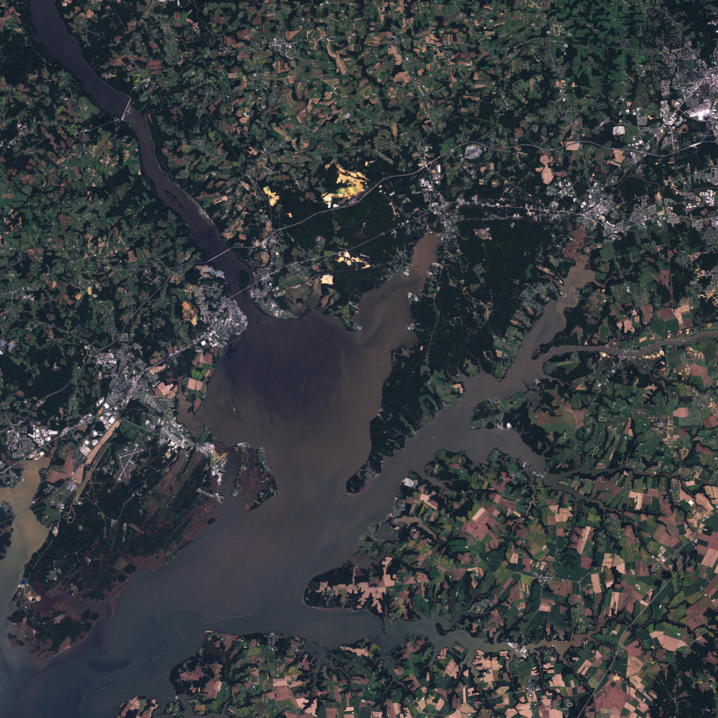
- Susquehanna River aerial — NASA / Public Domain
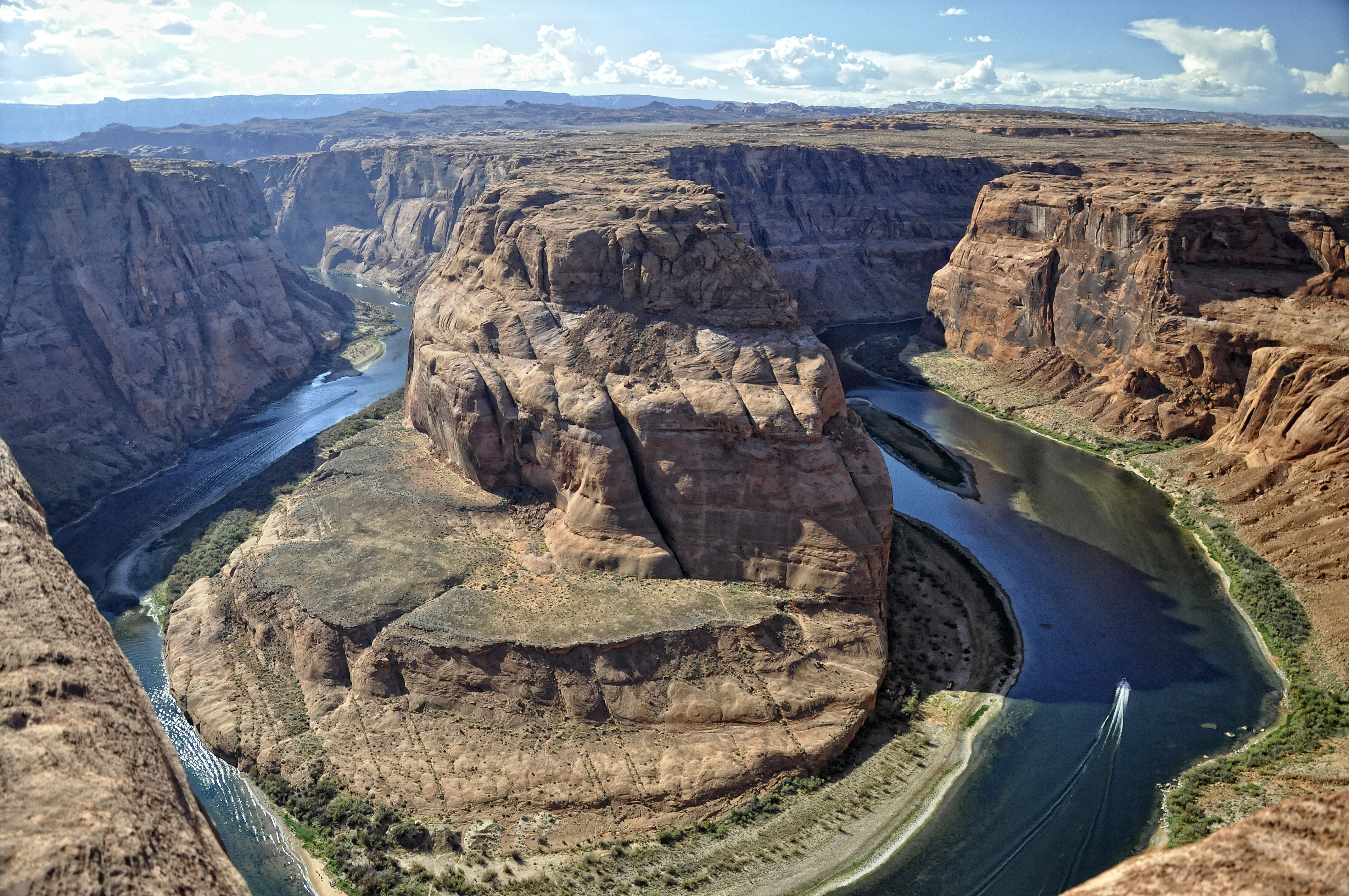
- Horseshoe Bend — Tucsonhipster / Wikimedia Commons, CC BY-SA 3.0
For the full written version of this story, see the companion guide: Where Your Glacial Gold Actually Comes From.